Residents, farmers, surveyors, and real estate professionals across Telangana often need access to village maps for land verification, survey identification, property planning, and documentation purposes. While official survey maps are available through public sources, accessing and understanding them can sometimes be challenging for the average user.
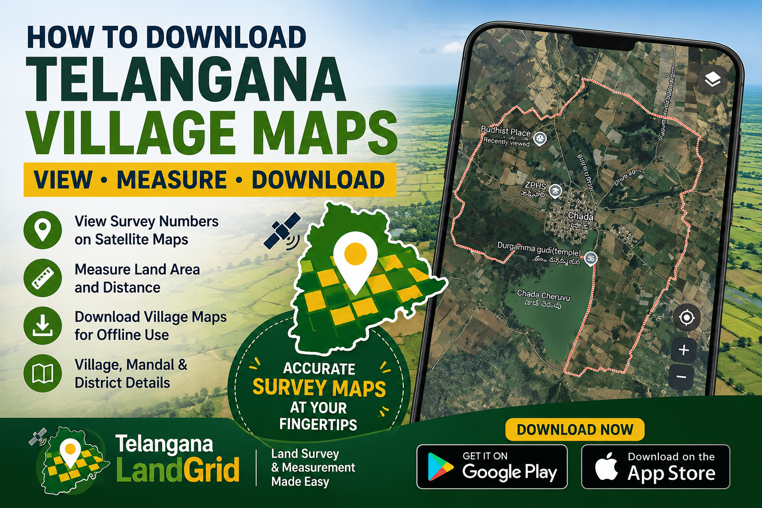
To simplify this process, mobile applications such as Telangana LandGrid are helping users view survey numbers, land boundaries, and village-level survey information directly on satellite maps.
Why Village Maps Are Important
Village maps contain valuable information such as:
- Survey numbers
- Land parcel boundaries
- Village boundaries
- Agricultural land layouts
- Property location references
- Area measurements
These maps are commonly used for property verification, land purchases, agricultural planning, surveying activities, and legal documentation.
Telangana LandGrid Makes Survey Maps Easier to Use
Telangana LandGrid is a mobile application designed to help users explore Telangana land survey data using an interactive satellite map interface.
Key features include:
- View survey numbers directly on satellite maps
- Search survey numbers instantly
- View Village, Mandal, and District details
- Measure land area and distances
- Save measurements for future reference
- GPS-based location support
- Survey boundary visualization
- Area display in Acres, Guntas, Square Meters, and Square Yards
The app currently provides access to more than 3.8 million survey records across Telangana.
Download Village Maps for Offline Use
Users can also purchase downloadable village survey maps through the Telangana LandGrid app.
Village maps are generated based on available survey data and can be downloaded for reference purposes.
Pricing varies depending on the number of survey records and the size of the village. Villages containing a larger number of survey parcels may require additional processing and storage resources, resulting in different pricing tiers.
The downloaded village maps can be useful for:
- Survey planning
- Agricultural land management
- Property inspections
- Field visits
- Offline reference in areas with limited internet connectivity
Download Telangana LandGrid
Android:
Download from the Google Play Store


Join The Discussion