Hyderabad: Checking land survey numbers in Telangana has become much easier with the help of modern mobile apps. Instead of visiting government offices or relying on manual records, users can now access survey boundaries, land details, and measurements directly on their smartphones using digital tools.
One such solution is the Telangana LandGrid App, which allows users to explore land survey data on interactive satellite maps. The app is designed for land buyers, property owners, surveyors, and real estate professionals who need quick and accurate access to land information.
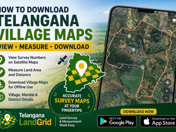
Step-by-Step: How to Check Survey Numbers on Mobile
Step 1: Download the Telangana LandGrid App from the official links below:
👉 Download for Android
👉 Download for iPhone
Step 2: Open the app and allow location (GPS) access for accurate results.
Step 3: Select your District, Mandal, and Village to load the relevant land records.
Step 4: The app will display survey numbers directly on satellite maps, allowing you to visually identify land parcels.
Step 5: Tap on any survey number to view area details (Acres/Guntas) and boundary information.
Step 6: Use the measurement tools to calculate land size or draw custom boundaries as needed.
Key Features of Telangana LandGrid App
- View Telangana survey boundaries on satellite maps
- Survey numbers displayed directly on the map
- Accurate land area details in Acres and Guntas
- Village, Mandal, and District data
- Advanced measurement tools
- Draw and save multiple measurements
- GPS-based location tracking
Why Use LandGrid for Land Verification?
The Telangana LandGrid App simplifies land verification by providing real-time visual data and reducing dependency on manual records. It is especially useful for:
- Property buyers verifying land before purchase
- Surveyors needing quick field data
- Real estate agents showcasing land details to clients
- Landowners checking boundaries and measurements
With increasing digital adoption, tools like LandGrid are transforming how land information is accessed in Telangana, making the process faster, transparent, and more reliable.


Join The Discussion